- LAND USE: TRANSIENT ECOLOGIES
- FWF
- 2010-2015
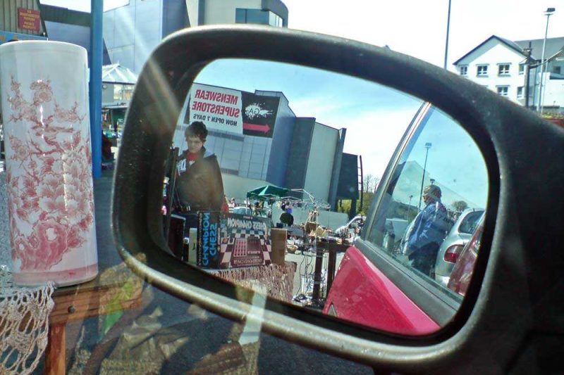
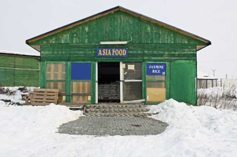
- Other Markets
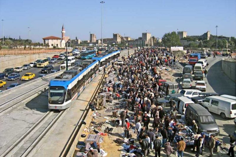
CASE STUDY: GUANGSHEN SUPERHIGHWAY MARKET
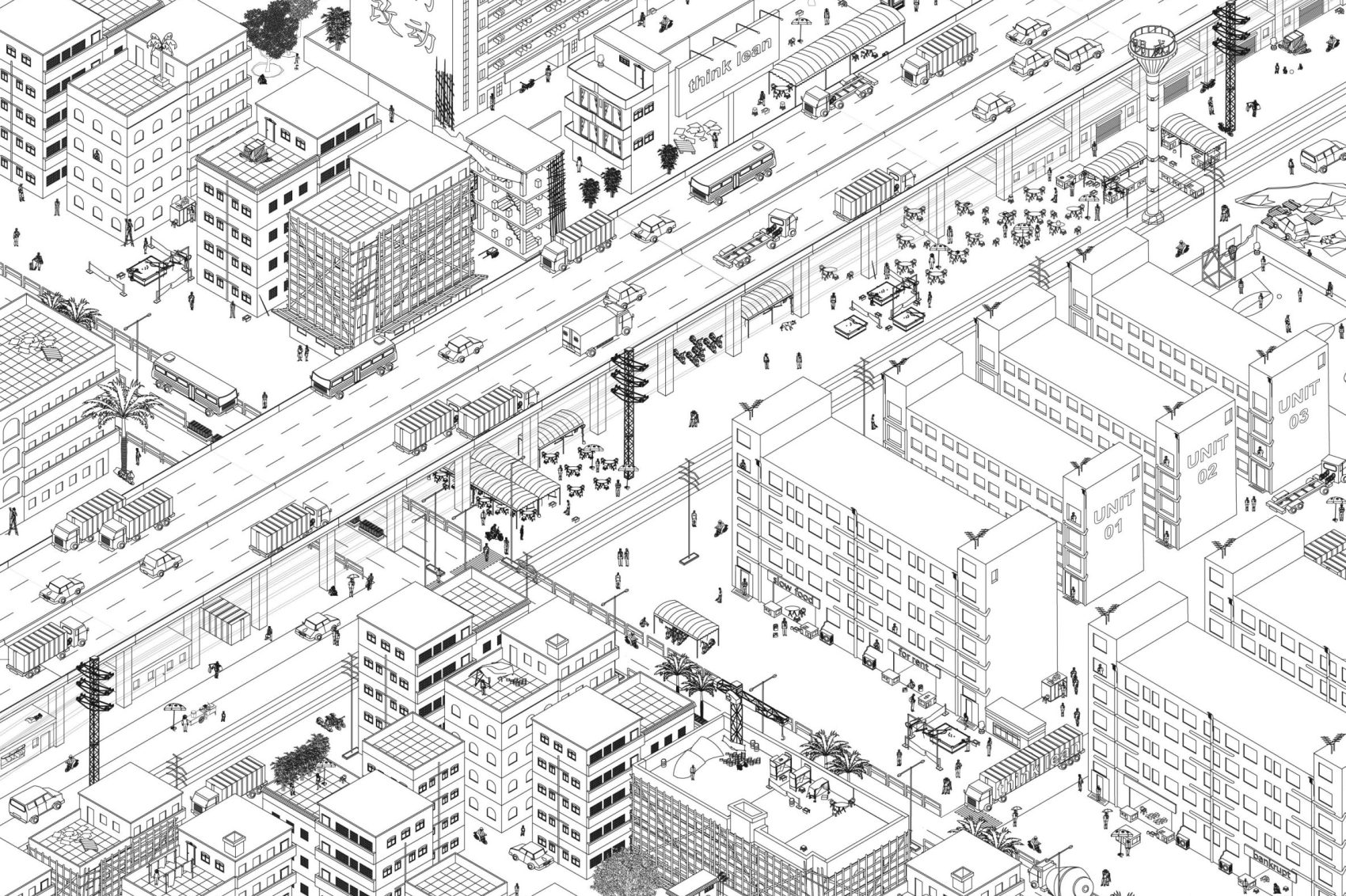
Guangshen Superhighway Market, schematic axonometry by MAP Office
UNDERNEATH – THE SUPERHIGHWAY MARKET
In the early 1980s, the Pearl River Delta (PRD) region was transformed into a vast manufacturing hinterland for Hong Kong, as well as an experimental zone for China’s new economy. Massive foreign investments from the British colony boosted a region that aspired to become the fifth Asian dragon.
Established by entrepreneurs, a politics of laissez faire was successfully injected into local infrastructural projects. Joint ventures and private money propelled a leap that responded to the global economy and accession to WTO.
The most visible trace of this recent development is a private highway – a 120-kilometer elevated strip between Shenzhen and Guangzhou. Owned by the developer Hopewell Holding and CEO Sir Gordon Wu, the Guangshen Superhighway is a unique platform which links cities and transfers merchandise from factories to container terminals. This suggests that the configuration of this strategic network is no longer determined by local factors but by a private empire that controls the economy, the planning and ultimately the culture of a region.
The dual 3-lane toll Superhighway provides 18 interchanges designed by Sir Gordon Wu (he is also an architect). Obviously the strategic position of these junctions has increased the surrounding land value and encouraged the formation of an urban corridor that will eventually transform the Pearl River Delta region into a single sprawling metropolis. A commercial structure was built at each interchange. Inspired by Le Corbusier’s Plan Obus for Algiers, the buildings were intended to serve an ambitious mixed-use program – commerce, office, factory, and dormitory – directly plugged into the underbelly of the infrastructure. Most of the 18 buildings were abandoned soon after completion. Today they shelter migrant squatters.
Location(s): Superhighway between Shenzhen and Guangzhou
On-Site Collaborator:
Laurent Gutierrez
Valérie PortefaixMAP Office
Visualisations:
Laurent Gutierrez
Valérie PortefaixMAP Office
Photography:
Laurent Gutierrez
Valérie PortefaixMAP Office
Results of this case study were published in:
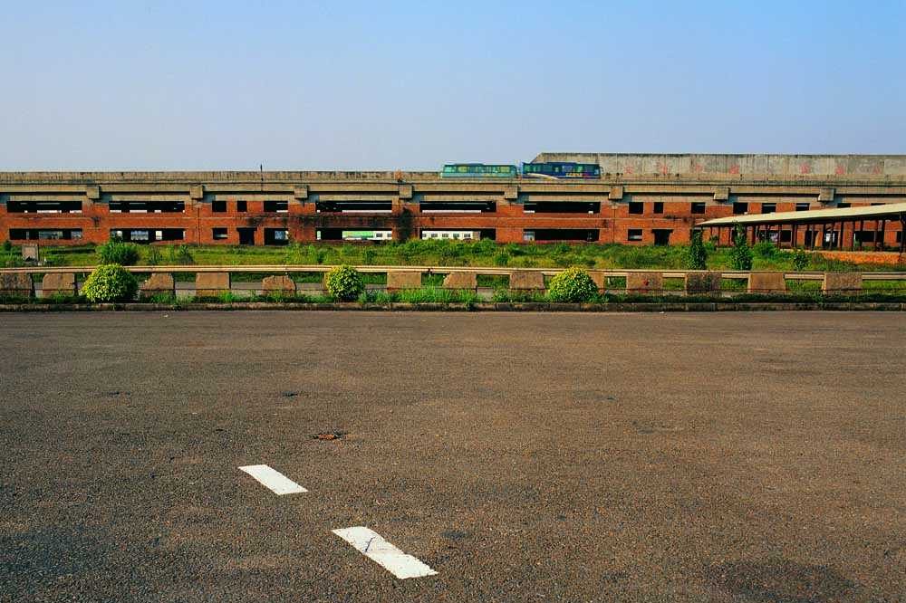
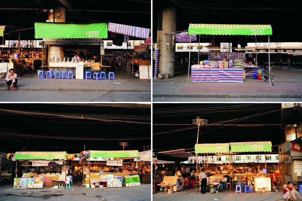
A linear shopping mall was built at each Superhighway entrance-exit node. Due to the dimension of the intersection nodes these structures remain disconnected from the city. Therefore the malls were never occupied and were left abandoned.
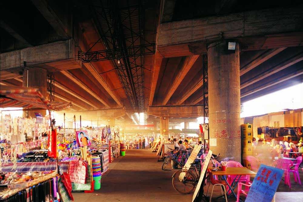
The market is divided into two stripes – merchandise and food. They both use the roof of the Superhighway to create an interior condition supported by diverting electricity from nearby power poles.
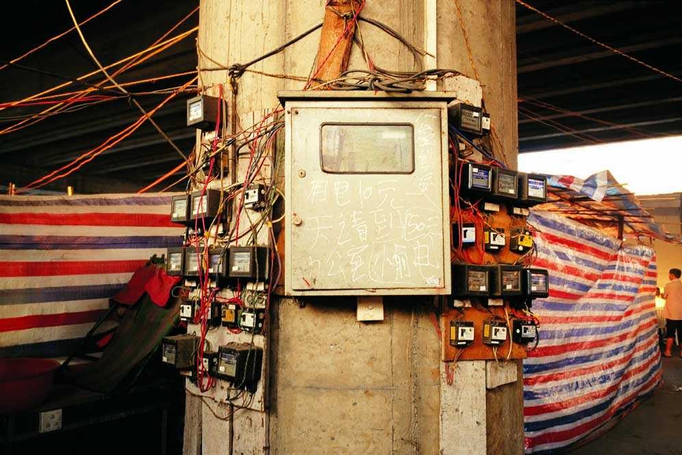
Light, ventilation, and small equipments (fridge, TV, computers) are freely powered by this illegal diversion.
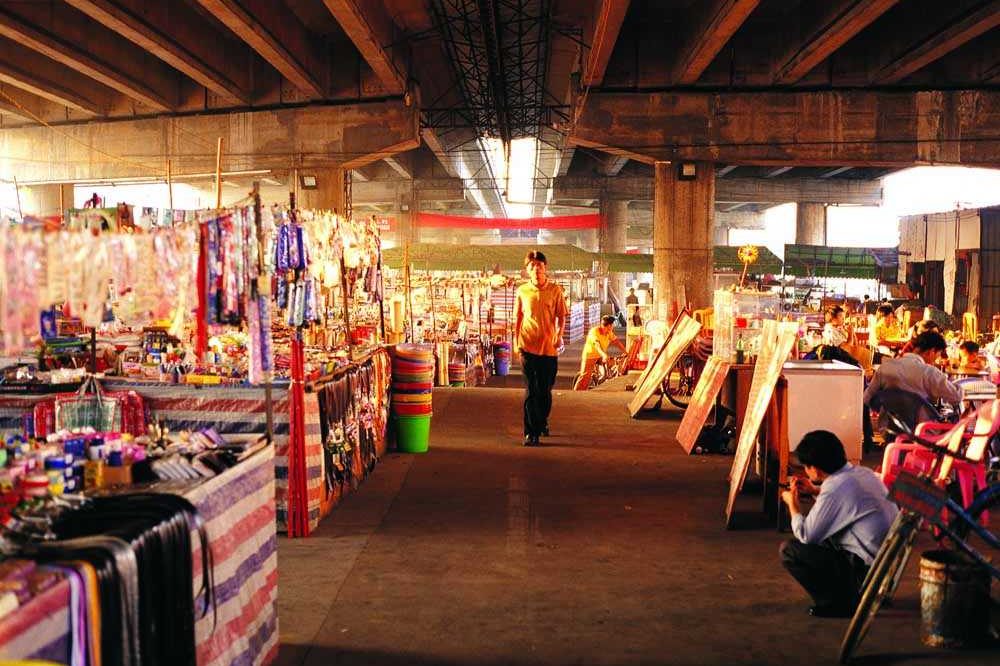
An analysis of the commodities on sale can explain much of the workers life: Most are small, cheap items.
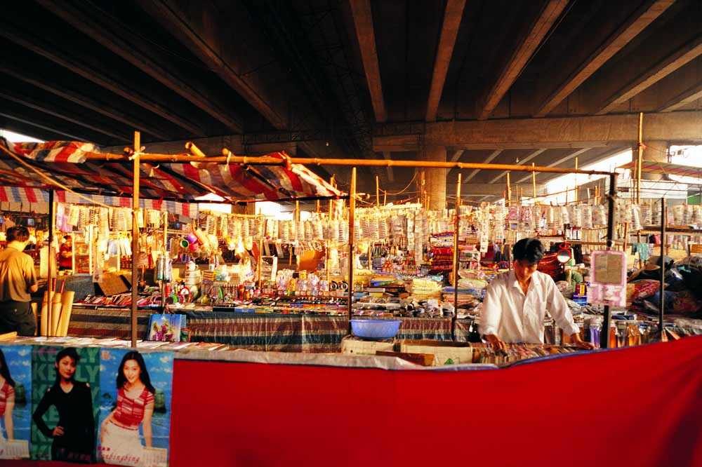
More than half concern the body: soap, shampoo, hygienic napkin, brushes, razor blades, cream and make up – everything to take care of oneself. This is a significant point: health and well-being.
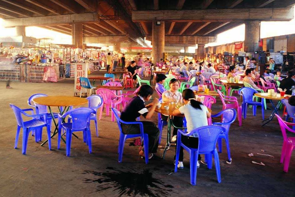
The users take a chair, order a meal and watch a DVD on TV.
Instead of using a remote to change film, customers change table. The restaurant is a collective living room where to watch TV, a video or meet with friends.
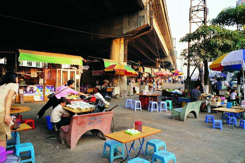
Where several chairs cluster together, entertainment islands are created for playing interactive games.
Computer networks or Internet cafés are proposing other possibilities and forms of exchange.
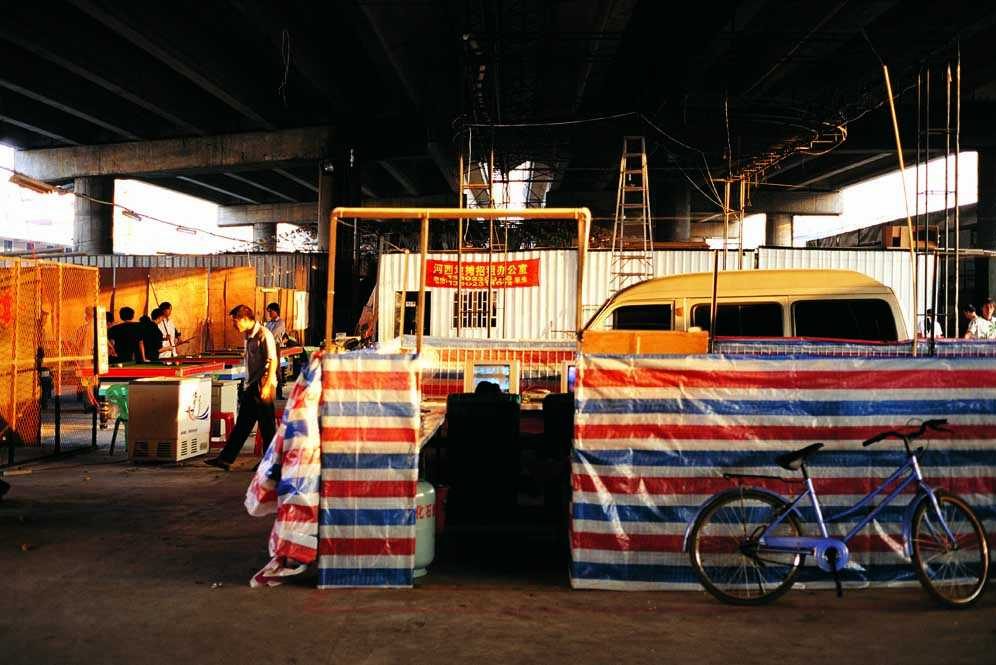
Traditional booth systems – light structures made of bamboo and fabric – have been used for long in China. They are still the cheapest system to occupy a small commercial space.
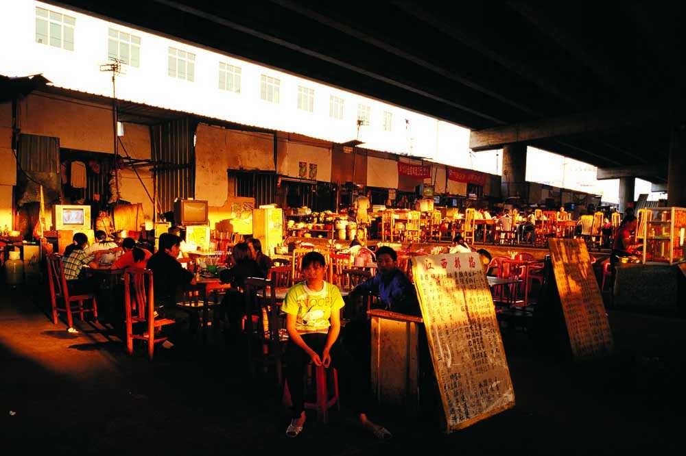
A massive open market exists underneath the Superhighway. Located in Songgan (half distance between Shenzhen and Guangzhou), this market is used by the workers to develop new social networks. It is a place where commodities are sold, services offered and food and entertainment consumed. You can take a chair, order a meal and watch a DVD on TV. Where several chairs cluster together, entertainment islands are created. The highway provides a roof and support for lighting and electricity. In the shadow of the highway, innovative economic activities arise and change with social demand. Another form of energy comes from the transitory condition of the land, people, TV screens, digital noise, and neon light. This hidden urbanity, which thrives on the vitality of a population almost entirely under the age of 25, represents the necessary motor that powers the PRD region.
Cycles of production and systems of distribution over the centuries have always been an emulator for shaping the human settlement. A strategic approach and politics of laissez-faire adopted by PRD local government bodies and then implemented by planners, architects and developers are in a sense the most up-to-date form of planning. As a result, the region has crystallised into a single urban entity based on the opportunistic adoption of a transport infrastructure built with private money and high tolls to serve the well-distributed factory. The Guangzhou superhighway, exclusive property of Gordon Wu’s Hopewell Holdings, is a major vector of this development. It suggests that the configuration of this strategic network is no longer determined by local factors but by a private empire that controls the economy, politics, planning and culture.
Another life takes root underneath the highway and surfaces at every interchange. Each of these exchange centres is located with an apparent lack of order in terms of geography or history, but is determined in terms of distance and connection to the other parts of the network. In this context, the tendency is to encourage opportunistic development that has the capacity to maximise the options between each of these places. Transportation terminals are remarkable examples of the new system, whereby the function of connecting and interchanging the masses with other modes of transport is broadened to include other uses such as commercial activities, leisure facilities, office and residential zones. Within this configuration, access becomes a measure of mobility and fluidity of urban expansion. In effect, these developments provide the necessary dynamics for a successfully competitive centre that is able to extend its influence into the territory. With no particular concern for spatial sequence or articulation, these extensive flow lines constitute an effective strategy for colonisation, transforming the landscape into a series of poly-nuclear construction systems, therefore reinforcing the hybrid condition of the territory.