- FWF
- 2023-2025
city layers
Conventional processes of data collection are asymmetric – they extract and aggregate information from urban areas and from populations which are construed as ‘profitable’, resulting in systemic exclusion of the communities, and forms of urban information deemed ‘unprofitable’. This raises questions of conclusiveness of collected measurable and simulated data from the environment in illustrating different aspects of urban spaces and processes.
How can we make future urban interventions more in sync with the citizens’ needs? How can citizens themselves contribute to the spatial changes they want to see in their cities?
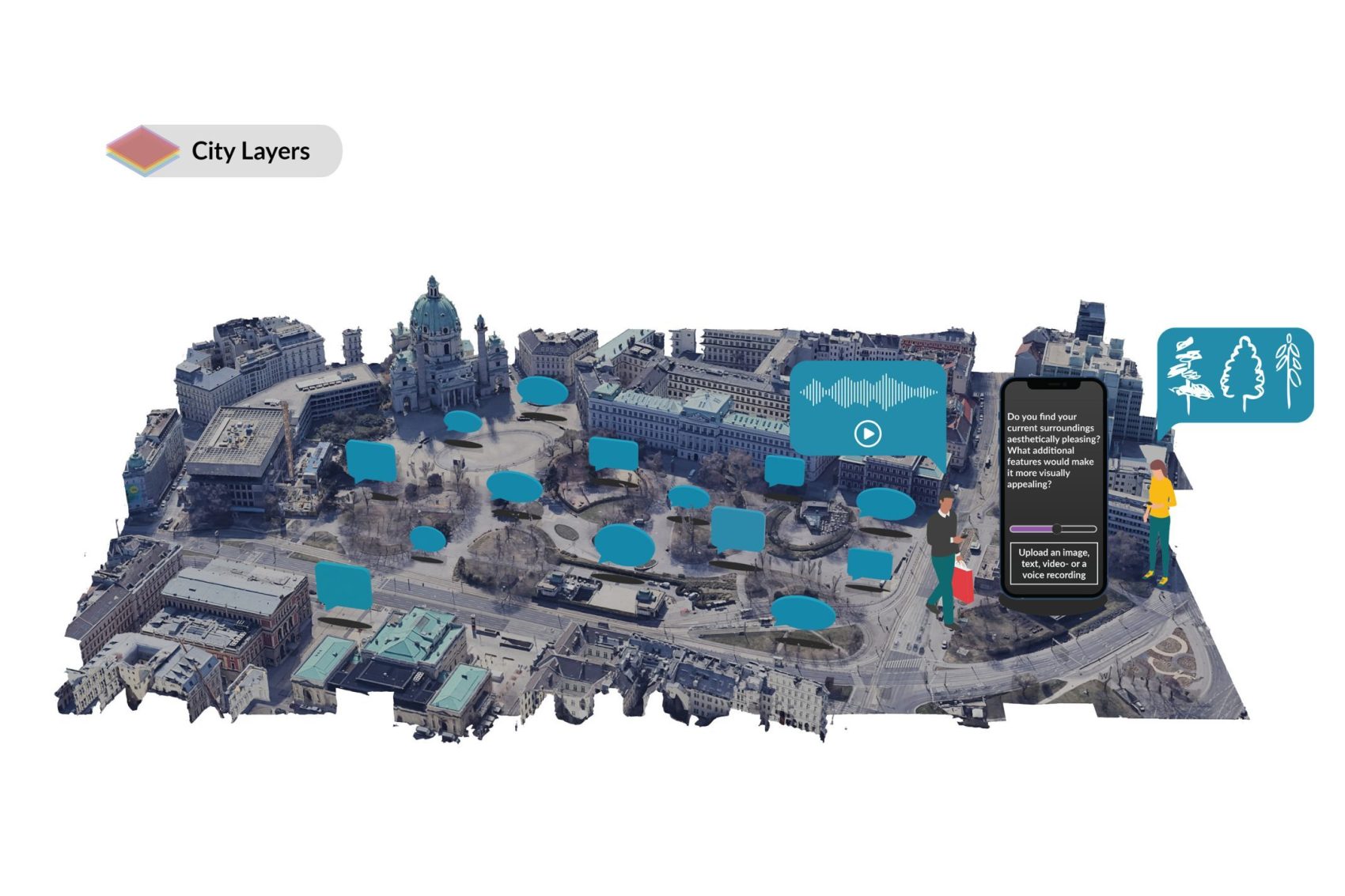
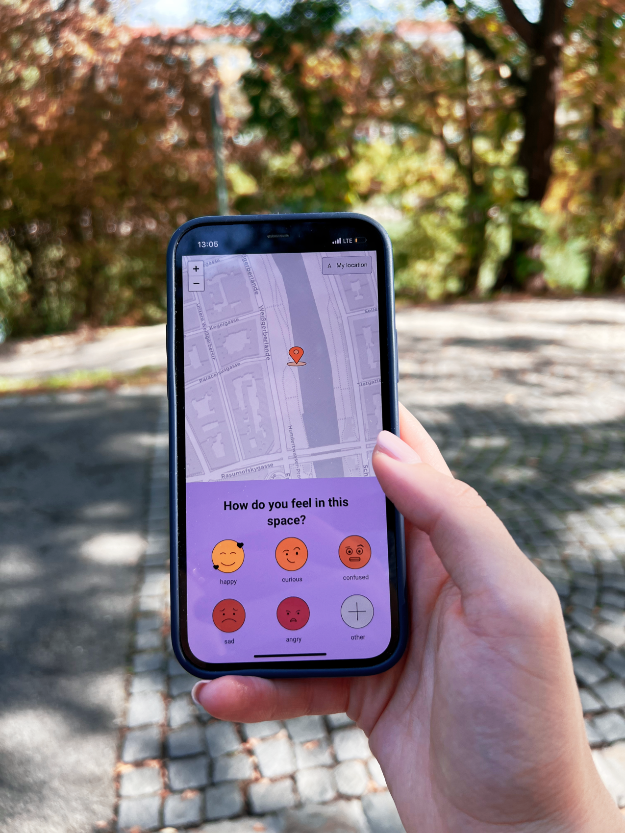
CITIZEN MAPPING AS A PRACTICE OF CITY-MAKING
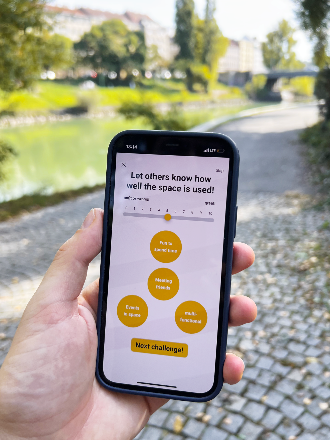
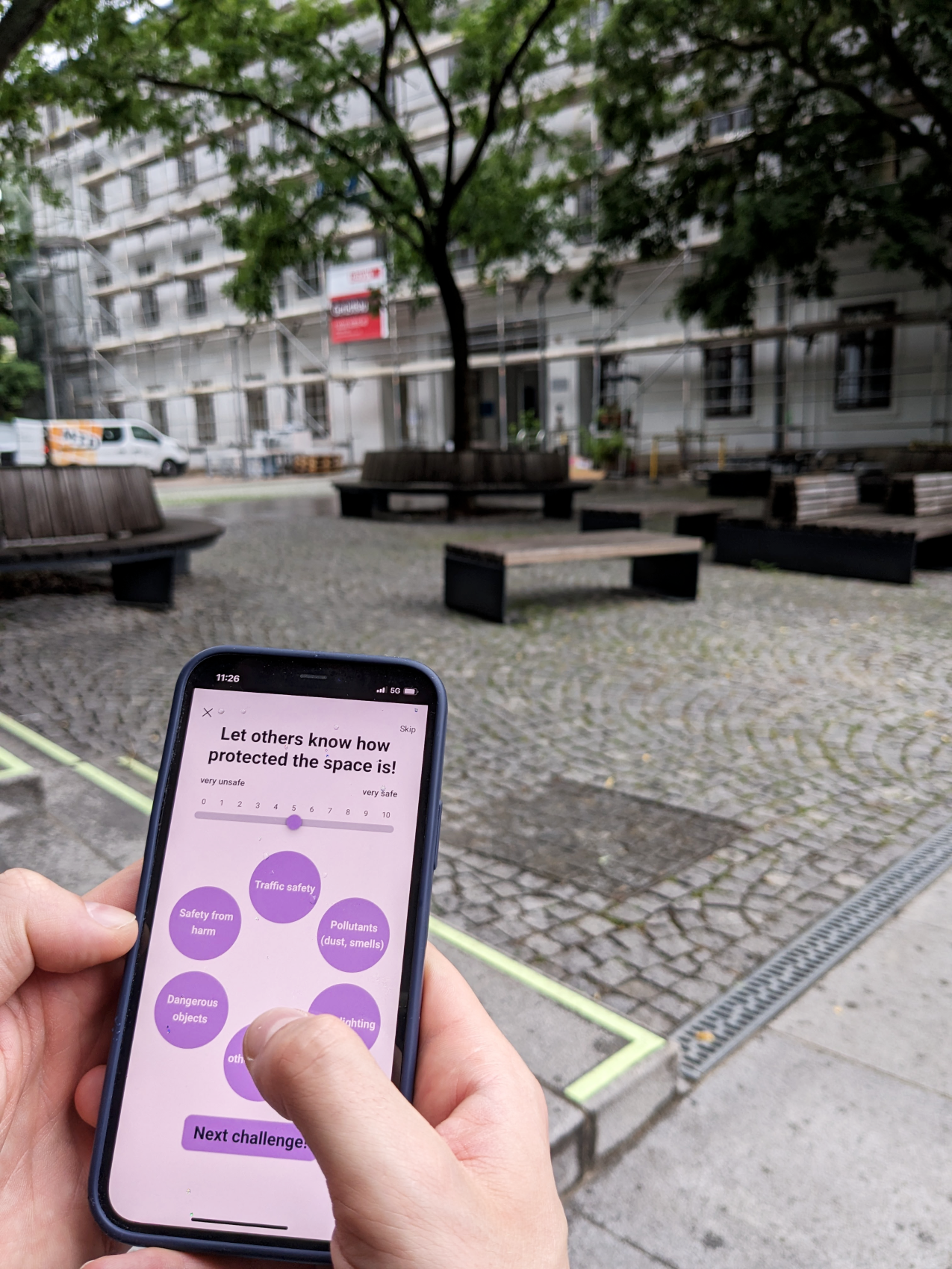
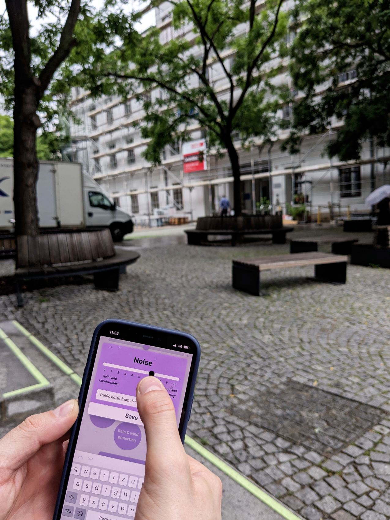
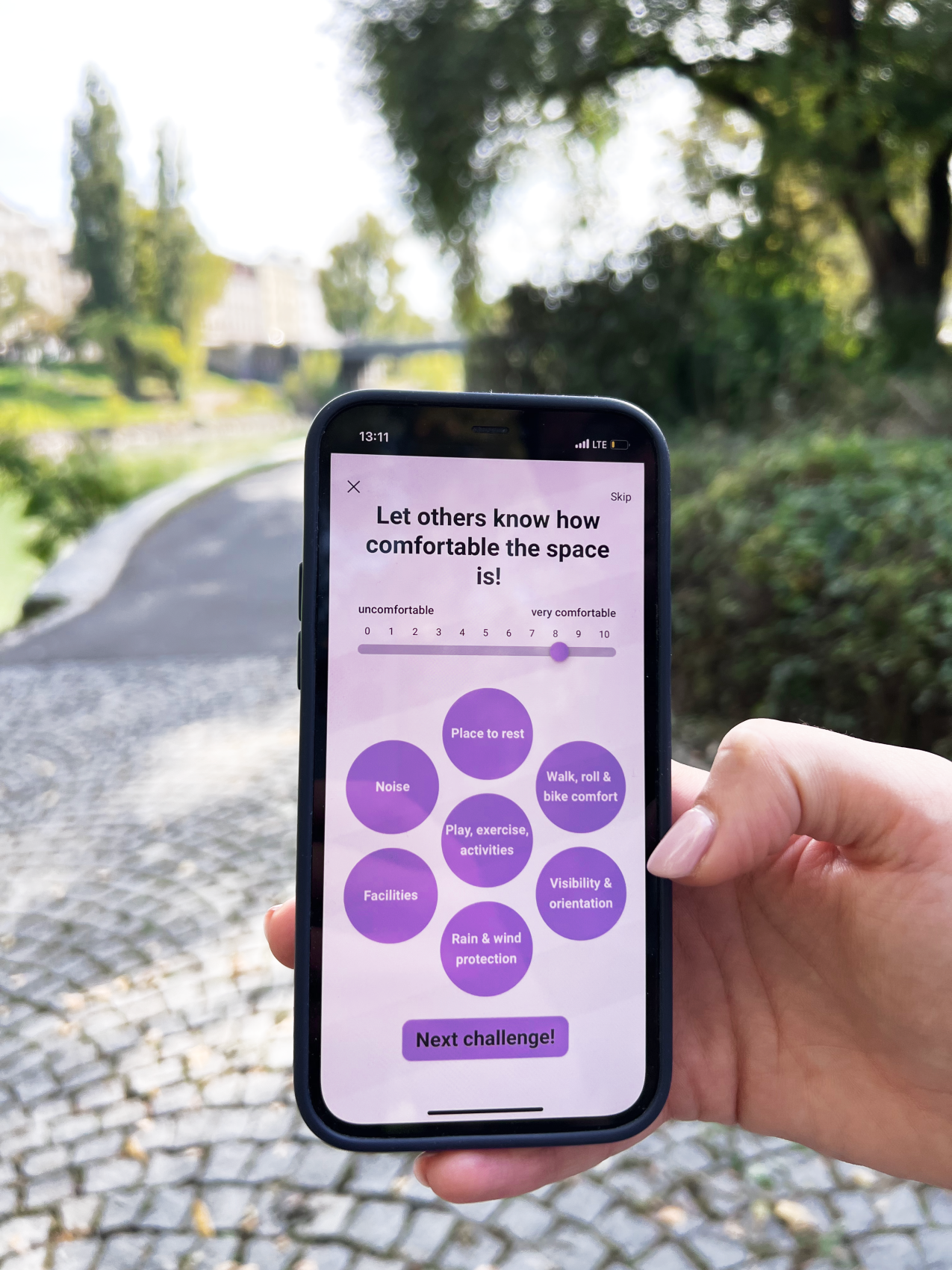
This project introduces an innovative framework for city-mapping which centres on citizen experience of urban space as an integrative way to contribute to more livable cities. The research aims to deepen the engagement between citizens and urban design by offering an app-based participatory tool that allows citizens to identify, record and reflect upon a range of different material and immaterial parameters in their cities, including accessibility, noise, safety, aesthetics, weather resistance, amenities and many more. The innovative city mapping app aims to become a means of communication between citizens and the city, with the aim of creating a new type of data that is collectively generated, managed and cared for.
Team
LOVRO KONCAR-GAMULIN, lead researcher
PETER MÖRTENBÖCK, project director
ANGELOS CHRONIS, app implementation and UX advisor
FIRAS SAFIEDDINE, app development expert
HONORATA GRZESIKOWSKA, app development expert
ANDRONIKI PAPPA, researcher
EVELINA JASKULSKA, researcher
CARMEN LAEL HINES, researcher and outreach expert
BILAL ALAME, research assistant
Funded by
AUSTRIAN SCIENCE FUND (FWF): TCS 135
City Layers App - Lovro Koncar-Gamulin
City Layers App - Lovro Koncar-Gamulin
City Layers App - Lovro Koncar-Gamulin
City Layers App - Lovro Koncar-Gamulin
City Layers App - Lovro Koncar-Gamulin
By recognizing and voicing their subjective experiences in specific spaces, citizens procure meaning and values, but also provide valuable data on how these spaces can be improved. Citizens’ contributions are made available online for active use. This innovative mapping tool thus aims to reorganise individual observations into collective knowledge and brings out the strengths of citizen participation in urban design. The collected data is intended to enable a basis for a better dialogue between those who use urban space and those who plan it. Therefore, the research recognises the citizen science approach as a democratic and urgent strategy for identifying the essential components which constitute a city.
The research defines ‘city layers’ as material and immaterial dimensions that constitute urban spaces and the processes occurring within them. Moreover, the research suggests that the term ‘city layers’ refers to not only the varied layers of a city which technological instruments could help to reveal, but also to the imagined figure of ‘city layers’.
Drawing on the term bricklayer, ‘city layers’ facilitate the material and immaterial mapping of the urban environment, and through these processes, citizens actively ‘lay’ the city, or lay active claim in its production through collective data production. In other words, by sharing subjective experiences and viewpoints of urban space citizens procure meaning and values, all of which contribute to the constitution of the cosmos of a particular space/city.
As part of the ÖAD (Austrian Agency for Education and Internationalization) Citizen Science Award, dedicated citizen scientists actively participated in the City Layers project
IMPETUS ACCELERATOR KICKSTARTING GRANT 2024
This grant supports the development of an innovative mobility dashboard that transforms citizen observations into real-time insights and actionable results